Parques Nacionais
Embora a primeira área natural do mundo a tornar-se numa área protegida tenha sido o Parque Nacional de Yellowstone (EUA, 1872), na Europa temos 250 parques nacionais, 23 dos quais estão localizados na Polónia, ocupando 1% do seu território. Estão localizados em quase todas as regiões do país e a sua variedade é surpreendente:

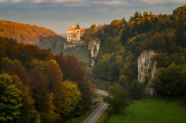
Localizado muito perto de Cracóvia, este parque nacional é uma alternativa para os viajantes que, embora visitando cidades históricas, não querem prescindir de actividades ao ar livre e do contacto com a natureza. A área protege a parte sul do planalto de Cracóvia-Częstochowa com os vales Prądnik e Sąspówka.
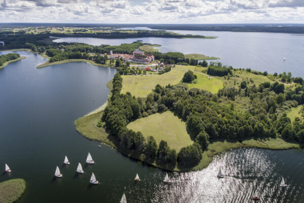
O elemento natural mais interessante deste parque, situado no nordeste da Polónia, são os seus lagos, sendo o maior deles o Wigry. Estes lagos estão conectados por uma rede de rios (o maior deles é o Czarna Hańcza).
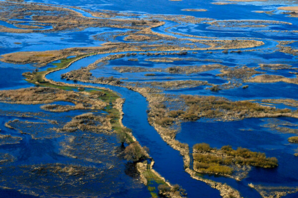
Para as aves, o vale do rio Biebrza é um dos últimos refúgios para sobreviver, já que a maioria dos pântanos naturais na Europa desapareceu.
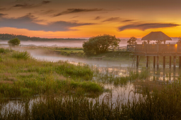
Na parte nordeste da Polónia, na região de Podlasie, encontram-se vários parques nacionais. Além do famoso parque de Białowieża, destaca-se o Parque Nacional do rio Narew (Narwiański Park Narodowy).
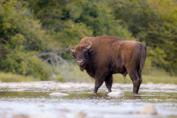
O rei dos parques nacionais na Polónia e na Europa é o Parque Nacional de Białowieża. Não é apenas um dos mais antigos do continente (criado em 1932), mas também o único lugar onde o bisonte europeu vive em liberdade (contando atualmente com mais de 300 exemplares) e onde se conserva, na reserva estrita, a chamada floresta primitiva, parte do parque não alterada há 400 anos pela atividade humana. Por isso, às vezes, fala-se da Selva de Białowieża.
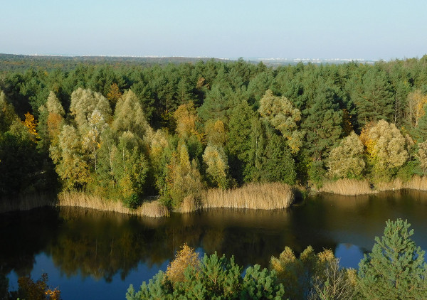
O Parque Nacional de Kampinos está localizado perto de Varsóvia. É o único parque nacional da Europa, e o segundo no mundo, situado junto a uma capital de estado. Foi criado principalmente com o objetivo de preservar os valores naturais da Floresta de Kampinos (Puszcza Kampinoska), que se estende pelo antigo vale do rio Vístula.
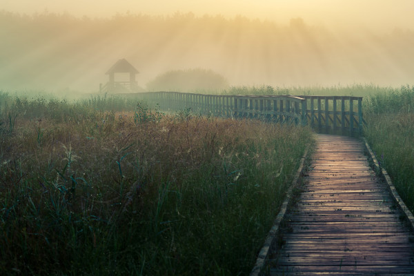
O parque está localizado na região dos lagos Łęczna – Włodawa (Pojezierze Łęczyńsko-Włodawskie) na Polesie de Lublin (Lubelskie Polesie).
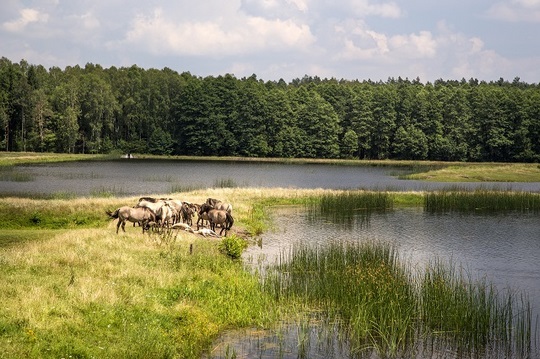
O parque ocupa a parte central do sistema montanhoso de Roztocze, na faixa central da Polónia oriental. As encostas suaves são cortadas por ravinas profundas.
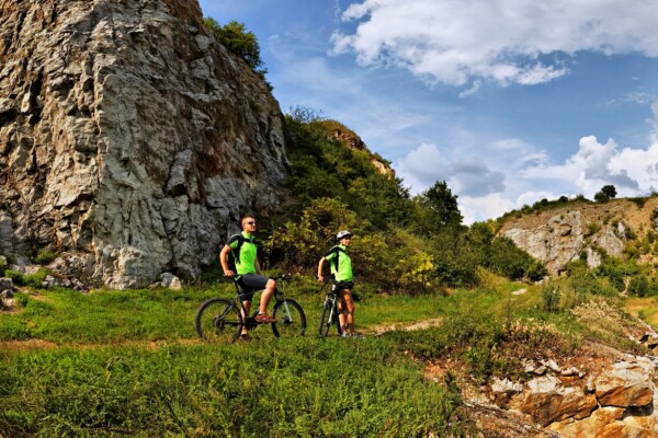
O parque alberga a parte mais alta dos Montes Świętokrzyskie (ou seja, as Montanhas da Santa Cruz): Łysa Góra (Monte Calvo), com o seu pico mais elevado, o Łysica (612 m), que pertencem às montanhas mais antigas da Polónia, compostas por rochas da era paleozóica. Uma das principais características do parque são as encostas das montanhas calvas, sem vegetação herbácea e cobertas de rochas.
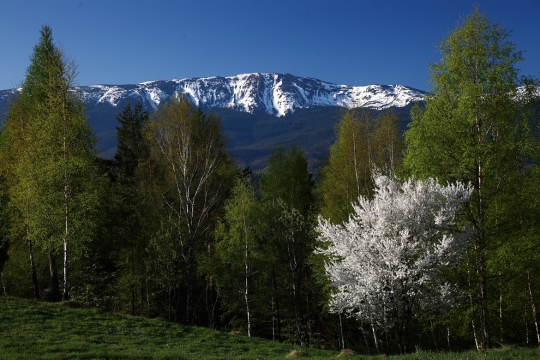
O Parque Nacional de Babia Góra engloba o ponto mais alto dos Żywiec Beskids: a montanha Babia Góra (1725 m). Está localizado no sul da Polónia e uma parte do parque forma a fronteira com a Eslováquia. Os escritórios estão situados em Zawoja (Polónia Menor), a 75 km de Zakopane, a 40 km de Żywiec e a pouco mais de 80 km de Cracóvia.
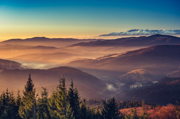
O Parque Nacional de Gorce protege a parte central das montanhas de Gorce (Beskids ocidentais), com exceção do pico mais alto, o Monte Turbacz (1310 m).
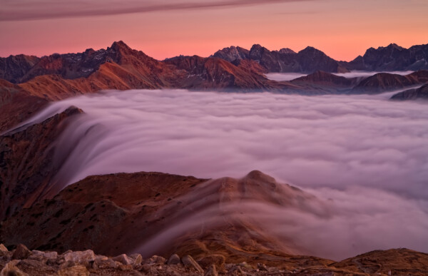
O parque protege o maciço de Tatra com o seu pico mais alto, o Monte Rysy (2499 m), o único na Polónia com carácter alpino.
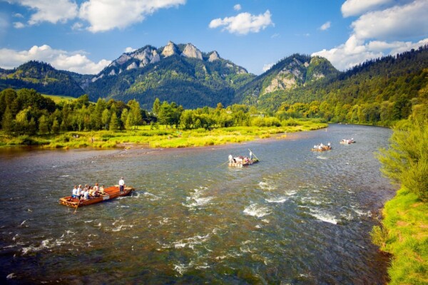
O parque abrange a parte central do maciço calcário de Pienines com o seu ponto mais alto, o Pico das Três Coroas (Trzy Korony, 982 m) e as pitorescas gargantas do rio Dunajec.
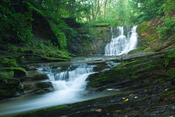
É uma área protegida na parte oriental da região de Malopolska (Pequena Polónia), que faz fronteira com a vizinha Subcarpática (Podkarpacie). O parque é constituído pela parte central dos Beskids inferiores (Beskid Niski) com o cume de Magura-Wątkowska (846 m).
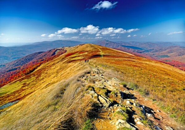
O Parque Nacional de Bieszczady, um dos mais “intactos” do país, situa-se na parte sudeste da região de Subcarpathian, na fronteira com a Ucrânia. Protege a parte mais elevada do Bieszczady Ocidental, que culmina no Monte Tarnica (1346 m).
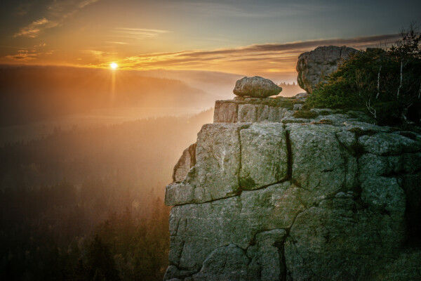
Ocupa uma área de seis mil hectares no cone sudoeste da Polónia, no condado de Kłodzko, pelo que se recomenda a sua visita quando se viaja por esta parte da Polónia ou se entra no país vindo da República Checa.
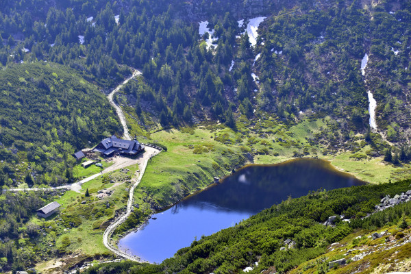
O parque inclui a parte mais alta dos Montes Sudetos – o Karkonosze, com o pico de Śnieżka (1603 m). Os locais naturais mais valiosos e pitorescos desta região montanhosa estão protegidos aqui: a área rochosa com circos glaciares, lagos de alta montanha, cascatas e monadnocks de formas curiosas.
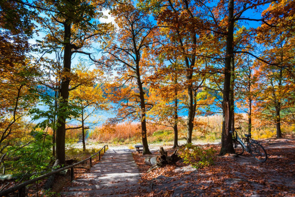
Localizado a 15 km de Poznań, o parque protege a natureza da região dos lagos da Grande Polónia (Pojezierze Wielkopolskie).
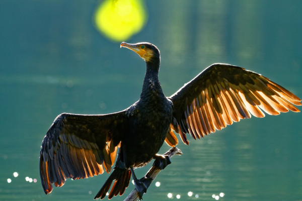
Uma pequena parte, a mais valiosa, do importante complexo florestal das florestas de Tuchola, que se estende por uma vasta planície, está protegida neste parque.
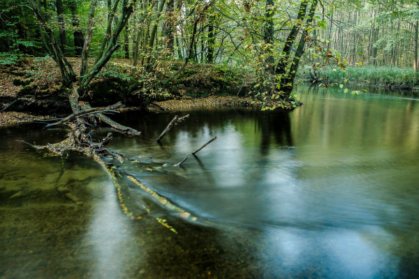
Situa-se na floresta de Drawa (Puszcza Drawska) e protege parte do vale do Drawa, um dos mais belos rios da Pomerânia polaca. A paisagem é típica do período pós-glacial. As florestas, principalmente de pinheiros, ocupam 80% da área.
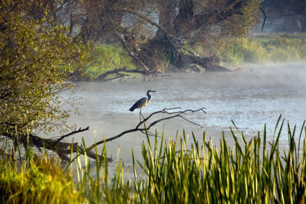
O Parque Nacional “Boca do Warta” está localizado na extremidade do Vale Toruń-Eberswalde (Pradolina Toruńsko-Eberswaldzka), nas proximidades da foz do rio Warta no Oder.
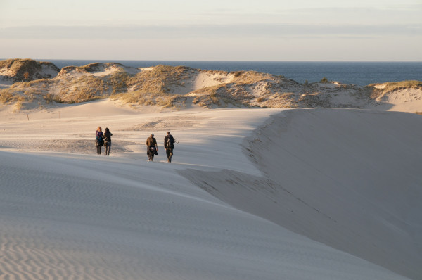
A principal curiosidade deste parque, situado na costa do Báltico, a cerca de 100 km de Gdansk, são as vastas extensões de dunas movediças, que em alguns locais revelam árvores mortas, restos de florestas cobertas de areia. A mais alta das dunas é Łącka Góra, com 42 m de altura.
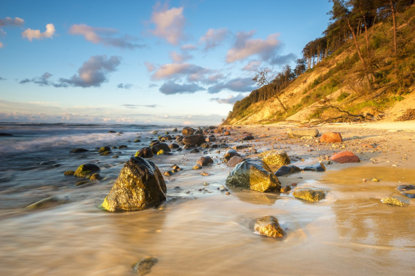
Wolin é uma ilha do Báltico situada na zona fronteiriça entre a Polónia e a Alemanha. O parque no seu conjunto inclui a parte ocidental da ilha de Wolin, com morenas que formam montes, que na costa do Báltico e na enseada de Szczecin formam falésias costeiras até 95 metros de altura, a parte mais bonita da costa de falésias polaca.
Os mais antigos foram formalmente criados em 1932. Tanto o Parque Nacional de Pieninski (perto de Cracóvia) como o Parque Nacional de Bialowieza (a 260 km de Varsóvia) foram, durante séculos, terrenos de caça reais e, por isso, restritos a outras pessoas;
O Parque Nacional de Bialowieza é de importância universal como habitat natural do bisonte europeu;
o mais jovem dos parques, o Delta de Warta (Ujscie Warty) na região de Wielkopolska, é o ponto de paragem das aves que viajam no outono para o sul da Europa;
o maior, o Parque Nacional de Biebrzanski, protege os maiores pântanos da Europa Central e as suas aves aquáticas;
o Parque Nacional do Rio Narew é o segundo no mundo cujo curso se assemelha a uma trança, visto de uma perspetiva aérea;
existem apenas duas “florestas” nas imediações de uma grande cidade, uma na Nigéria e a outra em Varsóvia, que é protegida pelo Parque Nacional Kampinoski;
Entre os mais populares e visitados estão o Parque Nacional de Tatra, o Parque Nacional de Karkonoski e o Slowinski com as famosas dunas movediças.


